Delivery: My Captures Section
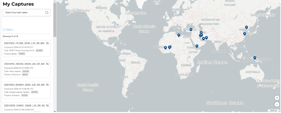
The My Captures section shows all imagery produced by your submitted tasks.
Map View: Captures are displayed on the map. Clicking on a capture reveals its associated details in the side panel.
Search and Filter: Narrow down results by task name, date range, and project.
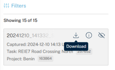
Capture Details: Click on an item in the list to zoom in on its location and view a preview. Options include:
-
Download: Download the imagery and associated metadata as a bundle.
-
Show Metadata: View details such as sun elevation, off-nadir angle, and cloud coverage.
-
Show/Hide Capture: Toggle the visibility of the capture preview on the map.

